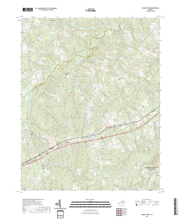
2022 Map of Church Road
USGS Topo · Published 2022About this map
The boundary between Amelia and Dinwiddie counties follows the meandering course of Namozine Creek in this southern Virginia landscape. The southeastern corner contains a portion of the Petersburg National Battlefield, preserving a critical site of Civil War history where Hatcher Run flows toward the Appomattox watershed. Transportation in the area is anchored by Cox Rd, which parallels the rail corridor serving the small communities of Walkers and Poole Siding Rd. Family history and local heritage are well-preserved through numerous small burying grounds, including Mispah Cem, Norris Cem, and the Mount Poole Baptist Church Cem. The map illustrates a rural settlement pattern defined by these early church sites and family-named roads like Pearson Hardy Rd and Anderson Mill Rd, set against a backdrop of complex creek systems like Whipponock Creek.
Find a feature on this map
66 named features on this map. Tap any name to fly to it.
Don’t see what you’re looking for? This feature index may not catch every label — zoom into the map to look around manually.
Map Details
Editions of this 2022 Church Road Map
This is the sole edition of this map. No revisions or reprints were ever made.
Other maps of this area

1897 · Amelia
USGS Topo · 1:125,000

1943 · Goodes Bridge
USGS Topo · 1:31,680

1943 · De Witt
USGS Topo · 1:24,000

1943 · Dinwiddie
USGS Topo · 1:24,000

1943 · Beach
USGS Topo · 1:24,000

1943 · Church Road
USGS Topo · 1:24,000

1943 · Winterpock
USGS Topo · 1:24,000

1943 · Sutherland
USGS Topo · 1:24,000

1943 · Richmond
USGS Topo · 1:250,000
1944 · Winterpock
USGS Topo · 1:31,680