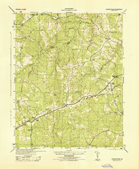
1944 Map of Church Road
USGS Topo · Published 1944About this map
Namozine Branch and Whipponock Creek wind through this mid-1940s landscape along the boundary between Amelia County and Dinwiddie County. The area is characterized by a dense network of country houses and rural crossroads, anchored by numerous small congregations such as Namozine Church, Trinity Church, and St Peters Church. The Norfolk and Western railway bisects the territory, facilitating local industry and commerce at points like Poole Siding and the Virginia State Quarry.
Find a feature on this map
22 named features on this map. Tap any name to fly to it.
Don’t see what you’re looking for? This feature index may not catch every label — zoom into the map to look around manually.
Map Details
Editions of this 1944 Church Road Map
This is the sole edition of this map. No revisions or reprints were ever made.
Other maps of this area

1897 · Amelia
USGS Topo · 1:125,000

1943 · Goodes Bridge
USGS Topo · 1:31,680

1943 · De Witt
USGS Topo · 1:24,000

1943 · Dinwiddie
USGS Topo · 1:24,000

1943 · Beach
USGS Topo · 1:24,000

1943 · Church Road
USGS Topo · 1:24,000

1943 · Winterpock
USGS Topo · 1:24,000

1943 · Sutherland
USGS Topo · 1:24,000

1943 · Richmond
USGS Topo · 1:250,000
1944 · Winterpock
USGS Topo · 1:31,680