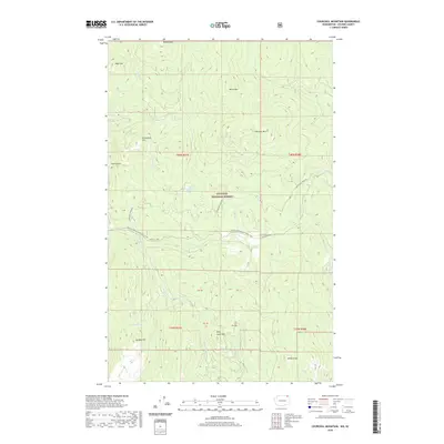
2020 Map of Churchill Mountain
USGS Topo · Published 2020About this map
The Colville National Forest dominates this northern Stevens County landscape, where the rugged peaks of the Selkirk Mountains transition toward the Canadian border. High-altitude landmarks like Churchill Mtn, Billy Goat Mtn, and Horns Mtn define a terrain shaped by deep drainages and isolated water bodies, including Easter Sunday Lake and Lamar Lake. The Churchill Mine stands as a point of industrial history near the center of the sheet, while the Pacific NW National Scenic Trail winds through the forest, tracing the ridgelines and creek valleys. This map illustrates a largely wild interior, where resource extraction and recreation meet. Canyons like Box Canyon and family-named landmarks such as Contention Hill offer specific points of interest for those tracing the history of land use and naming in this remote corner of Washington.
Find a feature on this map
31 named features on this map. Tap any name to fly to it.
Don’t see what you’re looking for? This feature index may not catch every label — zoom into the map to look around manually.
Map Details
Editions of this 2020 Churchill Mountain Map
This is the sole edition of this map. No revisions or reprints were ever made.
Other maps of this area

1929 · Colville
USGS Topo · 1:125,000

1933 · Colville
USGS Topo · 1:125,000

1936 · Marcus
USGS Topo · 1:96,000

1942 · Marcus
USGS Topo · 1:125,000

1948 · Orient
USGS Topo · 1:62,500

1951 · Orient
USGS Topo · 1:62,500

1954 · Okanogan
USGS Topo · 1:250,000

1958 · Okanogan
USGS Topo · 1:250,000

1958 · Sandpoint
USGS Topo · 1:250,000

1963 · Sandpoint
USGS Topo · 1:250,000