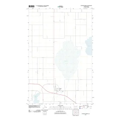
2011 Map of Churchs Ferry
USGS Topo · Published 2011About this map
Churchs Ferry sits at the heart of this North Dakota prairie landscape, where the local road network and hydrology reflect a deeply agricultural character. Large water bodies dominate the central and eastern portions of the quadrangle, notably Lake Irvine and a section of Lake Alice, while the smaller Stink Lake lies to the southwest. The town's grid is small and functional, with street names like Elevator Rd and Durum Dr nodding to the importance of the regional grain economy. To the south, Zion Cemetery provides a quiet marker of the community's genealogy, situated just off the intersection of County Hwy 2 and the section roads. This 2011 survey illustrates the flat, wetland-dotted terrain typical of Ramsey County, where the relationship between the rising waters of the lakes and the surrounding farmland is a primary geographical feature.
Find a feature on this map
27 named features on this map. Tap any name to fly to it.
Don’t see what you’re looking for? This feature index may not catch every label — zoom into the map to look around manually.
Map Details
Editions of this 2011 Churchs Ferry Map
This is the sole edition of this map. No revisions or reprints were ever made.
Other maps of this area

1932 · Grahams Island
USGS Topo · 1:62,500

1950 · Grahams Island
USGS Topo · 1:62,500

1951 · Tilden
USGS Topo · 1:24,000

1951 · Penn
USGS Topo · 1:24,000

1953 · Devils Lake
USGS Topo · 1:250,000

1956 · Devils Lake
USGS Topo · 1:250,000

1956 · Brinsmade
USGS Topo · 1:24,000

1957 · Cando SE
USGS Topo · 1:24,000

1957 · Cando
USGS Topo · 1:24,000

1957 · Cando NE
USGS Topo · 1:24,000