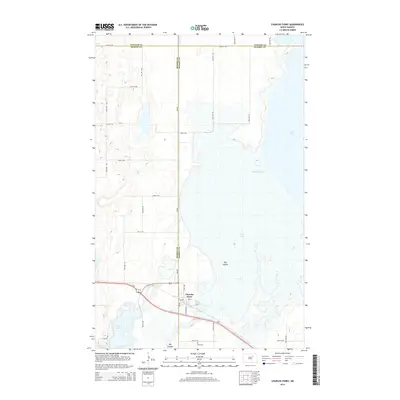
2014 Map of Churchs Ferry
USGS Topo · Published 2014About this map
Churchs Ferry serves as the focal point of this landscape, situated near the tri-county junction of Towner, Benson, and Ramsey counties. The settlement is positioned along the crossroads of Us-2 and Us-281, with local infrastructure like Elevator Rd and 3rd St indicating its role as a regional transport and agricultural hub. This map documents a period of significant hydrological presence, as the surrounding terrain is defined by an expansive network of waterways and wetlands including Lake Irvine, Lake Alice, and the Mauvais Coulee. To the south, Zion Cem stands as a local landmark near the banks of Big Coulee. The presence of Old US-281 and several section-line roads, such as 66th St NE and 64th Ave NE, provides a clear view of the rural grid system that organizes the North Dakota prairie.
Find a feature on this map
30 named features on this map. Tap any name to fly to it.
Don’t see what you’re looking for? This feature index may not catch every label — zoom into the map to look around manually.
Map Details
Editions of this 2014 Churchs Ferry Map
This is the sole edition of this map. No revisions or reprints were ever made.
Other maps of this area

1932 · Grahams Island
USGS Topo · 1:62,500

1950 · Grahams Island
USGS Topo · 1:62,500

1951 · Tilden
USGS Topo · 1:24,000

1951 · Penn
USGS Topo · 1:24,000

1953 · Devils Lake
USGS Topo · 1:250,000

1956 · Devils Lake
USGS Topo · 1:250,000

1956 · Brinsmade
USGS Topo · 1:24,000

1957 · Cando SE
USGS Topo · 1:24,000

1957 · Cando
USGS Topo · 1:24,000

1957 · Cando NE
USGS Topo · 1:24,000