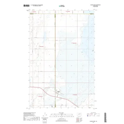
2017 Map of Churchs Ferry
USGS Topo · Published 2017About this map
Churchs Ferry sits at a critical intersection of hydrology and transport in the Devils Lake Basin of North Dakota. This survey shows the town center positioned between the expansive Lake Irvine and the meandering Mauvais Coulee, a landscape defined by the drainage patterns of the Big Coulee and Lake Alice to the north. The local economy and logistics are reflected in specific street names such as Elevator Rd and Durum Dr, pointing to the region's agricultural roots and grain handling infrastructure. Bordered by the lines of Benson and Ramsey counties, the map documents the proximity of the Churchs Ferry Cem and the various rural routes like Leeds Irvine that connect these remote prairie communities. The presence of numerous small wetlands and topographic depressions surrounding the town illustrates the dynamic water levels characteristic of this unique geographic region.
Find a feature on this map
32 named features on this map. Tap any name to fly to it.
Don’t see what you’re looking for? This feature index may not catch every label — zoom into the map to look around manually.
Map Details
Editions of this 2017 Churchs Ferry Map
This is the sole edition of this map. No revisions or reprints were ever made.
Other maps of this area

1932 · Grahams Island
USGS Topo · 1:62,500

1950 · Grahams Island
USGS Topo · 1:62,500

1951 · Tilden
USGS Topo · 1:24,000

1951 · Penn
USGS Topo · 1:24,000

1953 · Devils Lake
USGS Topo · 1:250,000

1956 · Devils Lake
USGS Topo · 1:250,000

1956 · Brinsmade
USGS Topo · 1:24,000

1957 · Cando SE
USGS Topo · 1:24,000

1957 · Cando
USGS Topo · 1:24,000

1957 · Cando NE
USGS Topo · 1:24,000