2020 Map of Churchs Ferry
USGS Topo · Published 2020About this map
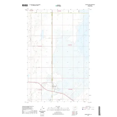
Churchs Ferry stands as a focal point in this portion of the northern plains, positioned at a critical junction of local transport and drainage near the border of Benson and Ramsey counties. The landscape is dominated by a complex hydrological network where the Mauvais Coulee feeds into the expansive Lake Irvine, which occupies a significant portion of the eastern map area. These water bodies, along with Lake Alice to the north, reflect the glacial prairie pothole region's character, where seasonal water levels dictate the use of the surrounding land. Local infrastructure, including Elevator Rd and the Churchs Ferry Cem, points to a long-standing agricultural community structured around the township and range survey system. The town's grid, featuring Orvis Ave and 3rd St, serves as the primary hub for the sparsely populated rural stretches extending toward Towner County.
Find a feature on this map
22 named features on this map. Tap any name to fly to it.
Don’t see what you’re looking for? This feature index may not catch every label — zoom into the map to look around manually.
Map Details
Editions of this 2020 Churchs Ferry Map
This is the sole edition of this map. No revisions or reprints were ever made.
Other maps of this area

1932 · Grahams Island
USGS Topo · 1:62,500

1950 · Grahams Island
USGS Topo · 1:62,500

1951 · Tilden
USGS Topo · 1:24,000

1951 · Penn
USGS Topo · 1:24,000

1953 · Devils Lake
USGS Topo · 1:250,000

1956 · Devils Lake
USGS Topo · 1:250,000

1956 · Brinsmade
USGS Topo · 1:24,000

1957 · Cando SE
USGS Topo · 1:24,000

1957 · Cando
USGS Topo · 1:24,000

1957 · Cando NE
USGS Topo · 1:24,000