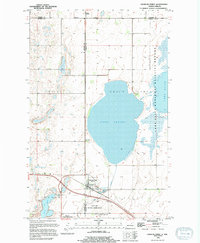
1994 Map of Churchs Ferry
USGS Topo · Published 1994About this map
Churchs Ferry serves as a central hub in this prairie landscape, situated near the intersection of the Burlington Northern railroad and Highway 281. The topography is dominated by an extensive hydrological network known as the Chain Lakes, with Lake Irvine forming a massive central basin. This aquatic system is vital for local conservation efforts, evidenced by the presence of the Lake Alice National Wildlife Refuge and Silver Lake National Wildlife Refuge along the eastern and southern edges. To the north, the small settlement of Maza sits just across the county line. The map captures a transition in the land, where the drainage of Mauvais Coulee and Big Coulee feeds into the lakes, and the Churchs Ferry Cem provides a local genealogical landmark south of the town center.
Find a feature on this map
20 named features on this map. Tap any name to fly to it.
Don’t see what you’re looking for? This feature index may not catch every label — zoom into the map to look around manually.
Map Details
Editions of this 1994 Churchs Ferry Map
This is the sole edition of this map. No revisions or reprints were ever made.
Other maps of this area

1932 · Grahams Island
USGS Topo · 1:62,500

1950 · Grahams Island
USGS Topo · 1:62,500

1951 · Tilden
USGS Topo · 1:24,000

1951 · Penn
USGS Topo · 1:24,000

1953 · Devils Lake
USGS Topo · 1:250,000

1956 · Devils Lake
USGS Topo · 1:250,000

1956 · Brinsmade
USGS Topo · 1:24,000

1957 · Cando SE
USGS Topo · 1:24,000

1957 · Cando
USGS Topo · 1:24,000

1957 · Cando NE
USGS Topo · 1:24,000