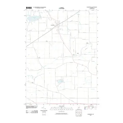
2010 Map of Churubusco
USGS Topo · Published 2010About this map
Churubusco serves as the primary hub in this Whitley County landscape, where the town's geometry is defined by the intersection of several regional roads. The surrounding terrain is a complex hydrologic network, with the Eel River and its numerous tributaries and man-made channels like Maloney Ditch, Johnson Drain, and Churubusco Branch sculpting the agricultural fields. This 2010 survey reveals a land deeply tied to its lineage, evidenced by a high density of small family or community burial grounds, including Jeffries Cemetery and Watterson Cemetery. To the north, Blue Lake and Devils Lake create a distinct recreational and natural pocket, while Lake Everett anchors the southern portion of the quadrangle. The map details an era of modern rural life where historical drainage patterns continue to dictate the placement of farms and transit corridors like Old Trail Rd.
Find a feature on this map
73 named features on this map. Tap any name to fly to it.
Don’t see what you’re looking for? This feature index may not catch every label — zoom into the map to look around manually.
Map Details
Editions of this 2010 Churubusco Map
This is the sole edition of this map. No revisions or reprints were ever made.
Other maps of this area

1951 · Merriam
USGS Topo · 1:24,000

1953 · Fort Wayne
USGS Topo · 1:250,000

1955 · Columbia City
USGS Topo · 1:24,000

1955 · Ege
USGS Topo · 1:24,000

1956 · Fort Wayne
USGS Topo · 1:250,000

1956 · Fort Wayne West
USGS Topo · 1:24,000

1957 · Huntertown
USGS Topo · 1:24,000

1957 · Garrett
USGS Topo · 1:24,000

1957 · Churubusco
USGS Topo · 1:24,000

1961 · Arcola
USGS Topo · 1:24,000