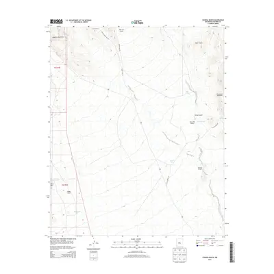
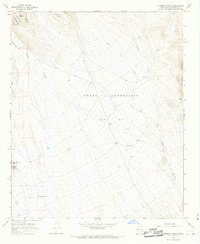
2013 Map of Cienega Ranch
USGS Topo · Published 2013About this map
Cienega Ranch sits at the heart of this Socorro County landscape, positioned within a complex network of arroyos and desert canyons. The terrain is defined by the high elevations of the Magdalena Mountains to the west and the Chupadera Mountains to the east, creating a corridor of drainage paths like Torreon Arroyo and Nogal Canyon. Water management is central to the land's utility, evidenced by the distribution of numerous named tanks and springs across the dry basin. Features such as Cement Tank, Horse Mountain Tank, and Homestead Tank highlight the ranching infrastructure required for survival in this arid environment. Navigation across the ranch land is facilitated by a series of named tracks, including Cienega Camp Rd and Coyote Springs Rd, which connect remote landmarks like Horse Mtn and Ryan Hill Canyon to the broader regional topography.
Find a feature on this map
22 named features on this map. Tap any name to fly to it.
Don’t see what you’re looking for? This feature index may not catch every label — zoom into the map to look around manually.
Map Details
Editions of this 2013 Cienega Ranch Map
This is the sole edition of this map. No revisions or reprints were ever made.
Other maps of this area

1948 · San Antonio
USGS Topo · 1:62,500

1948 · Val Verde
USGS Topo · 1:62,500

1954 · Tularosa
USGS Topo · 1:250,000

1958 · Tularosa
USGS Topo · 1:250,000

1961 · Hickman Ranch
USGS Topo · 1:24,000

1961 · Fort Craig
USGS Topo · 1:24,000
1965 · Puertecito Gap
USGS Topo · 1:24,000
1965 · South Baldy
USGS Topo · 1:24,000
1965 · Molino Peak
USGS Topo · 1:24,000
1965 · Cienega Ranch
USGS Topo · 1:24,000