
1961 Map of Hickman Ranch
USGS Topo · Published 1963About this map
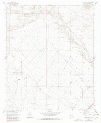
Hickman Ranch serves as a primary reference point in this arid New Mexico landscape, situated at the confluence of several prominent drainage systems. The terrain is defined by a network of deep incisions including North Canyon, Red Canyon, and East Canyon, which drain the higher elevations toward the east. The map illustrates a complex topographical transition through Puertocito Gap, where the rugged landforms give way to the winding course of Milligan Gulch. Survey control points such as VABM Donna and VABM Sheep mark the high ground between the various canyon systems, like Eaton Canyon and San Juan Canyon. This 1961 field check shows a landscape of sparse development, where geographic features like Sheep Canyon and Rock Creek dictate the movement and location of the few established ranching outposts.
Find a feature on this map
12 named features on this map. Tap any name to fly to it.
Don’t see what you’re looking for? This feature index may not catch every label — zoom into the map to look around manually.
Map Details
Editions of this 1961 Hickman Ranch Map
2 editions found
Other maps of this area

1954 · Tularosa
USGS Topo · 1:250,000

1958 · Tularosa
USGS Topo · 1:250,000

1961 · Paraje Well
USGS Topo · 1:24,000

1961 · Black Hill
USGS Topo · 1:24,000

1961 · Fort Craig
USGS Topo · 1:24,000

1964 · San Juan Peak
USGS Topo · 1:24,000

1964 · Steel Hill
USGS Topo · 1:24,000
1965 · Tenmile Hill
USGS Topo · 1:24,000
1965 · Puertecito Gap
USGS Topo · 1:24,000
1965 · Cienega Ranch
USGS Topo · 1:24,000