
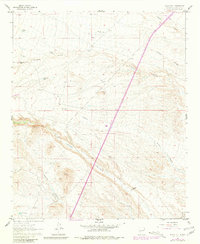
1961 Map of Black Hill
USGS Topo · Published 1963About this map
W Coupland Ranch and a network of water catchment systems characterize this arid landscape in Socorro County during the early 1960s. The map reveals the critical importance of water management in this high-desert environment, documented by the presence of numerous man-made basins including Wallace Tank, Beeman Tank, and the C C C Tank. These features suggest a history of livestock ranching and possible public works projects across the terrain.
Find a feature on this map
14 named features on this map. Tap any name to fly to it.
Don’t see what you’re looking for? This feature index may not catch every label — zoom into the map to look around manually.
Map Details
Editions of this 1961 Black Hill Map
2 editions found
Other maps of this area

1954 · Tularosa
USGS Topo · 1:250,000

1958 · Tularosa
USGS Topo · 1:250,000

1961 · Sierra Fijardo
USGS Topo · 1:24,000

1961 · Hickman Ranch
USGS Topo · 1:24,000

1961 · Paraje Well
USGS Topo · 1:24,000

1961 · Fort Craig
USGS Topo · 1:24,000

1961 · Lava
USGS Topo · 1:24,000

1961 · Romero Canyon
USGS Topo · 1:24,000

1964 · San Juan Peak
USGS Topo · 1:24,000

1964 · Steel Hill
USGS Topo · 1:24,000