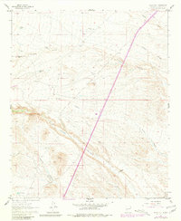
1961 Map of Black Hill
USGS Topo · Published 1981About this map
W Coupland Ranch and G Coupland Ranch anchor this high-desert region of Socorro County, showing the scattered ranching infrastructure of the mid-20th century. The landscape is defined by its drainage systems, most notably the wide cut of Nogal Canyon and the surrounding network of Lumbre Canyon, Silver Canyon, and Chaunte Canyon. These deep natural features dictated the placement of essential water resources, represented by isolated landmarks like Wallace Tank, Scott Tank, and the CCC Tank, which points to earlier land management efforts by the Civilian Conservation Corps. Above the canyons, prominent elevations like Black Hill and Bottle Hill serve as navigational markers, while a remote Landing Strip near the northern boundary highlights the reliance on air travel for accessing this interior reach of New Mexico.
Find a feature on this map
17 named features on this map. Tap any name to fly to it.
Don’t see what you’re looking for? This feature index may not catch every label — zoom into the map to look around manually.
Map Details
Editions of this 1961 Black Hill Map
2 editions found
Other maps of this area

1954 · Tularosa
USGS Topo · 1:250,000

1958 · Tularosa
USGS Topo · 1:250,000

1961 · Sierra Fijardo
USGS Topo · 1:24,000

1961 · Hickman Ranch
USGS Topo · 1:24,000

1961 · Paraje Well
USGS Topo · 1:24,000

1961 · Black Hill
USGS Topo · 1:24,000

1961 · Fort Craig
USGS Topo · 1:24,000

1961 · Lava
USGS Topo · 1:24,000

1961 · Romero Canyon
USGS Topo · 1:24,000

1964 · San Juan Peak
USGS Topo · 1:24,000