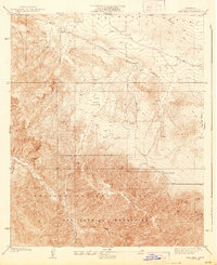
1939 Map of Cima Mesa
USGS Topo · Published 1939About this map
The San Andreas Rift Zone carves a distinct geological path across this 1930s landscape, marking the transition between the high desert of the Antelope Valley and the steep slopes of the San Gabriel Mountains. This survey captures the sparse, ranch-oriented settlement patterns of high-elevation Los Angeles County, where water sources like the Pallett Creek and various unnamed springs dictated the placement of homesteads. Local family operations, including Saunders Ranch and Stanton Ranch, are situated along the lower slopes and canyons, providing a window into the rural life of the era before modern expansion.
Find a feature on this map
21 named features on this map. Tap any name to fly to it.
Don’t see what you’re looking for? This feature index may not catch every label — zoom into the map to look around manually.
Map Details
Editions of this 1939 Cima Mesa Map
2 editions found
Other maps of this area

1900 · Tujunga
USGS Topo · 1:62,500

1901 · Southern California Sheet No. 1
USGS Topo · 1:250,000

1903 · Rock Creek
USGS Topo · 1:62,500

1904 · Southern California Sheet No. 1
USGS Topo · 1:250,000

1915 · Elizabeth Lake
USGS Topo · 1:125,000

1917 · Elizabeth Lake
USGS Topo · 1:125,000

1930 · Little Rock
USGS Topo · 1:24,000

1930 · Llano
USGS Topo · 1:24,000

1930 · Pearland
USGS Topo · 1:24,000

1934 · Pearland
USGS Topo · 1:24,000