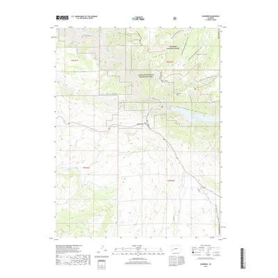
2019 Map of Cimarron
USGS Topo · Published 2019About this map
Cimarron sits at a critical junction of high-country water and transport in Montrose County, where the Cimarron River meets the canyonlands. This landscape is defined by the steep transition from the high flat tops of Poverty Mesa and Black Mesa down into the sheer depths of the Black Canyon of the Gunnison. The 2019 survey shows the complex water management of the region, including the Morrow Point Reservoir and irrigation infrastructure such as the Cimarron Ditch and Collier Ditch. These waterways support the livestock and agricultural life of the valley while the surrounding Gunnison National Forest and Curecanti National Recreation Area preserve the dramatic verticality of Morrow Point and Sheep Knob. Trail systems like the Hermits Rest Trail and Mesa Creek Trail reflect the modern recreational use of these historical cattle and transit routes.
Find a feature on this map
37 named features on this map. Tap any name to fly to it.
Don’t see what you’re looking for? This feature index may not catch every label — zoom into the map to look around manually.
Map Details
Editions of this 2019 Cimarron Map
This is the sole edition of this map. No revisions or reprints were ever made.
Other maps of this area

1908 · Uncompahgre
USGS Topo · 1:125,000

1909 · Montrose
USGS Topo · 1:125,000

1911 · Uncompahgre
USGS Topo · 1:125,000

1911 · Montrose
USGS Topo · 1:125,000

1956 · Curecanti Needle
USGS Topo · 1:24,000

1956 · Cimarron
USGS Topo · 1:24,000

1956 · Montrose
USGS Topo · 1:250,000

1957 · Cathedral Peak
USGS Topo · 1:24,000

1957 · X Lazy F Ranch
USGS Topo · 1:24,000

1957 · Cerro Summit
USGS Topo · 1:24,000