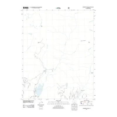
2011 Map of Cimarrona Peak
USGS Topo · Published 2011About this map
Williams Creek Reservoir dominates the southwestern corner of this high-elevation mountain terrain, managed via the Williams Creek Dam and Mullins Dam. The landscape is defined by the steep drainage basins of the Middle Fork Piedra River and several tributary systems including Williams Creek, Cimarrona Creek, and Squaw Creek. This 2011 survey captures the area's primary use for back-country recreation and water management, with established camps such as Cimarrona Campground and Teal Campground situated along the forest roads.
Find a feature on this map
23 named features on this map. Tap any name to fly to it.
Don’t see what you’re looking for? This feature index may not catch every label — zoom into the map to look around manually.
Map Details
Editions of this 2011 Cimarrona Peak Map
This is the sole edition of this map. No revisions or reprints were ever made.
Other maps of this area

1905 · San Cristobal
USGS Topo · 1:125,000

1907 · San Cristobal
USGS Topo · 1:125,000

1924 · Pagosa Springs
USGS Topo · 1:125,000

1927 · Pagosa Springs
USGS Topo · 1:125,000

1945 · Durango
USGS Topo · 1:250,000

1953 · Durango
USGS Topo · 1:250,000

1954 · Durango
USGS Topo · 1:250,000

1961 · Durango
USGS Topo · 1:250,000

1963 · Durango
USGS Topo · 1:250,000
1964 · Bear Mountain
USGS Topo · 1:24,000