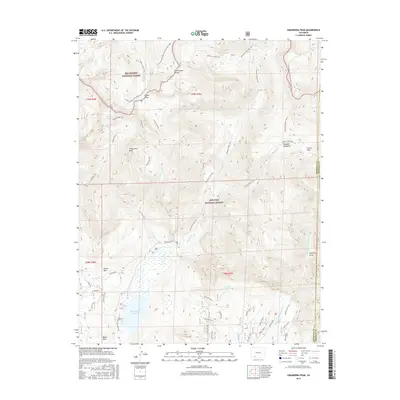
2016 Map of Cimarrona Peak
USGS Topo · Published 2016About this map
Cimarrona Peak and the high ridges of the Continental Divide define this wilderness landscape within the Rio Grande National Forest and San Juan National Forest. The map documents a complex network of backcountry routes, including the Continental Divide National Scenic Trail and the Cimarrona Trail, which navigate the steep transition from the peaks down to the Williams Cr Reservoir. Evidence of high-altitude hydrology is everywhere, from the clustered Palisade Lakes and Hossick Lake to the headwaters of the Middle Fork Piedra River. Topographic names like Porphyry Gulch, Poison Park, and Pistol Park hint at the rugged character of this backcountry area, while Squaw Pass serves as a key crossing point along the divide.
Find a feature on this map
43 named features on this map. Tap any name to fly to it.
Don’t see what you’re looking for? This feature index may not catch every label — zoom into the map to look around manually.
Map Details
Editions of this 2016 Cimarrona Peak Map
This is the sole edition of this map. No revisions or reprints were ever made.
Other maps of this area

1905 · San Cristobal
USGS Topo · 1:125,000

1907 · San Cristobal
USGS Topo · 1:125,000

1924 · Pagosa Springs
USGS Topo · 1:125,000

1927 · Pagosa Springs
USGS Topo · 1:125,000

1945 · Durango
USGS Topo · 1:250,000

1953 · Durango
USGS Topo · 1:250,000

1954 · Durango
USGS Topo · 1:250,000

1961 · Durango
USGS Topo · 1:250,000

1963 · Durango
USGS Topo · 1:250,000
1964 · Bear Mountain
USGS Topo · 1:24,000