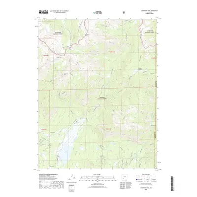
2019 Map of Cimarrona Peak
USGS Topo · Published 2019About this map
Cimarrona Peak and the surrounding high-altitude terrain define this 2019 survey of the San Juan and Rio Grande National Forests. The Continental Divide National Scenic Trail winds along the crest, crossing Squaw Pass and tracing the boundary between Mineral and Hinsdale counties. This area serves as a primary headwater for several major drainages, with the Middle Fork Piedra River and Williams Cr collecting runoff from the steep slopes.
Find a feature on this map
54 named features on this map. Tap any name to fly to it.
Don’t see what you’re looking for? This feature index may not catch every label — zoom into the map to look around manually.
Map Details
Editions of this 2019 Cimarrona Peak Map
This is the sole edition of this map. No revisions or reprints were ever made.
Other maps of this area

1905 · San Cristobal
USGS Topo · 1:125,000

1907 · San Cristobal
USGS Topo · 1:125,000

1924 · Pagosa Springs
USGS Topo · 1:125,000

1927 · Pagosa Springs
USGS Topo · 1:125,000

1945 · Durango
USGS Topo · 1:250,000

1953 · Durango
USGS Topo · 1:250,000

1954 · Durango
USGS Topo · 1:250,000

1961 · Durango
USGS Topo · 1:250,000

1963 · Durango
USGS Topo · 1:250,000
1964 · Bear Mountain
USGS Topo · 1:24,000