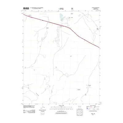
2011 Map of Ciniza
USGS Topo · Published 2011About this map
Industrial infrastructure meets a high-altitude landscape in this survey of New Mexico’s Eastern Navajo Agency. The Ciniza Refinery and its associated settlement of Ciniza dominate the northern corridor, served by the Refinery Interchange and the aptly named Giant Xing. This area represents a critical node for the region's energy economy, situated just south of the South Fork Puerco River.
Find a feature on this map
26 named features on this map. Tap any name to fly to it.
Don’t see what you’re looking for? This feature index may not catch every label — zoom into the map to look around manually.
Map Details
Editions of this 2011 Ciniza Map
This is the sole edition of this map. No revisions or reprints were ever made.
Other maps of this area

1886 · Wingate
USGS Topo · 1:250,000

1892 · Wingate
USGS Topo · 1:250,000

1954 · Gallup
USGS Topo · 1:250,000

1958 · Gallup
USGS Topo · 1:250,000

1959 · Gallup
USGS Topo · 1:250,000

1961 · Cottonwood Canyon
USGS Topo · 1:24,000

1962 · Gallup
USGS Topo · 1:250,000

1962 · Ciniza
USGS Topo · 1:24,000

1962 · Continental Divide
USGS Topo · 1:24,000

1962 · Cottonwood Canyon
USGS Topo · 1:24,000