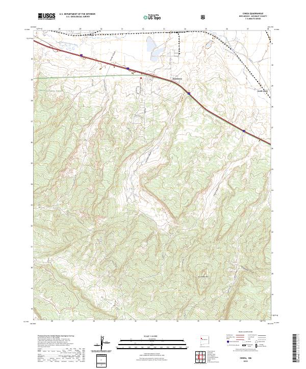
2023 Map of Ciniza
USGS Topo · Published 2023About this map
Cibola National Forest encompasses the southern half of this McKinley County landscape, where the terrain rises sharply toward Barometer Mtn and the prominent McKenzie Ridge. The northern corridor is defined by the South Fork Puerco River valley, a vital transportation artery hosting the settlements of Jamestown, Perea, and South Guam. This area demonstrates a classic Western alignment of modern infrastructure—including Interstate 40 and various county roads like Co RD 27—overlaid upon the traditional drainage patterns of the high desert.
Find a feature on this map
23 named features on this map. Tap any name to fly to it.
Don’t see what you’re looking for? This feature index may not catch every label — zoom into the map to look around manually.
Map Details
Editions of this 2023 Ciniza Map
This is the sole edition of this map. No revisions or reprints were ever made.
Other maps of this area

1886 · Wingate
USGS Topo · 1:250,000

1892 · Wingate
USGS Topo · 1:250,000

1954 · Gallup
USGS Topo · 1:250,000

1958 · Gallup
USGS Topo · 1:250,000

1959 · Gallup
USGS Topo · 1:250,000

1961 · Cottonwood Canyon
USGS Topo · 1:24,000

1962 · Gallup
USGS Topo · 1:250,000

1962 · Ciniza
USGS Topo · 1:24,000

1962 · Continental Divide
USGS Topo · 1:24,000

1962 · Cottonwood Canyon
USGS Topo · 1:24,000