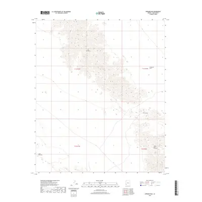
2018 Map of Cipriano Pass
USGS Topo · Published 2018About this map
The Gila Mountains dominate the central spine of this 2018 survey, providing a detailed look at the arid topography of Yuma County. The map documents the stark transition from the high peaks down into the Lechuguilla Desert to the east and the Butler Mountains to the west. This territory is defined by its dramatic relief and natural corridors, most notably the Cipriano Pass which cuts between the Gila and the Tinajas Altas Mountains in the southeastern quadrant. The absence of modern development highlights the preserved nature of these public lands, where the terrain itself dictates the movement of people and wildlife through the Sonoran landscape. Researchers will find the detailed contour intervals essential for understanding the drainage patterns and desert bajadas that characterize this remote corner of the American Southwest.
Find a feature on this map
9 named features on this map. Tap any name to fly to it.
Don’t see what you’re looking for? This feature index may not catch every label — zoom into the map to look around manually.
Map Details
Editions of this 2018 Cipriano Pass Map
This is the sole edition of this map. No revisions or reprints were ever made.
Other maps of this area

1926 · Fortuna
USGS Topo · 1:62,500

1926 · Wellton
USGS Topo · 1:62,500

1929 · Fortuna
USGS Topo · 1:62,500

1929 · Wellton
USGS Topo · 1:62,500

1942 · Yuma
USGS Topo · 1:250,000

1954 · El Centro
USGS Topo · 1:250,000

1955 · El Centro
USGS Topo · 1:250,000

1958 · El Centro
USGS Topo · 1:250,000

1961 · El Centro
USGS Topo · 1:250,000

1964 · El Centro
USGS Topo · 1:250,000