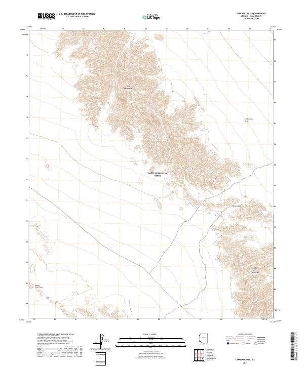
2021 Map of Cipriano Pass
USGS Topo · Published 2021About this map
Cipriano Pass serves as a central corridor within this arid landscape of Yuma County, positioned between the steep rises of the Gila Mountains and the Tinajas Altas Mountains. The topography here is defined by high-elevation ridges that overlook the broad expanses of the Lechuguilla Desert. To the southwest, the Butler Mountains emerge as a distinct separate formation. This survey illustrates the convergence of several major southwestern mountain ranges, showing the stark relief and physical barriers that have historically dictated travel routes and land use in this corner of the Sonoran region. The map detail highlights the relationship between the narrow passage of Cipriano Pass and the surrounding basin-and-range geology.
Find a feature on this map
9 named features on this map. Tap any name to fly to it.
Don’t see what you’re looking for? This feature index may not catch every label — zoom into the map to look around manually.
Map Details
Editions of this 2021 Cipriano Pass Map
This is the sole edition of this map. No revisions or reprints were ever made.
Other maps of this area

1926 · Fortuna
USGS Topo · 1:62,500

1926 · Wellton
USGS Topo · 1:62,500

1929 · Fortuna
USGS Topo · 1:62,500

1929 · Wellton
USGS Topo · 1:62,500

1942 · Yuma
USGS Topo · 1:250,000

1954 · El Centro
USGS Topo · 1:250,000

1955 · El Centro
USGS Topo · 1:250,000

1958 · El Centro
USGS Topo · 1:250,000

1961 · El Centro
USGS Topo · 1:250,000

1964 · El Centro
USGS Topo · 1:250,000