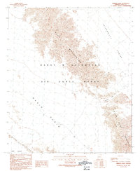
1990 Map of Cipriano Pass
USGS Topo · Published 1991About this map
Barry M Goldwater Air Force Range occupies a central role in this desert landscape, where military geography meets the natural isolation of the Southwest. The terrain is defined by the sharp rise of the Gila Mountains and the Tinajas Altas Mountains, separated by the lower elevation of Cipriano Pass. This passage serves as a critical navigation point between the Lechuguilla Desert to the east and the broad Davis Plain to the west. The presence of numerous bench marks across the arid flats of the Yuma Desert and Butler Mountains indicates the precision required for surveying this active military training area. For researchers, the map provides a clear record of the access roads and unimproved trails that traverse these remote desert basins and mountain passes.
Find a feature on this map
18 named features on this map. Tap any name to fly to it.
Don’t see what you’re looking for? This feature index may not catch every label — zoom into the map to look around manually.
Map Details
Editions of this 1990 Cipriano Pass Map
This is the sole edition of this map. No revisions or reprints were ever made.
Other maps of this area

1926 · Fortuna
USGS Topo · 1:62,500

1926 · Wellton
USGS Topo · 1:62,500

1929 · Fortuna
USGS Topo · 1:62,500

1929 · Wellton
USGS Topo · 1:62,500

1942 · Yuma
USGS Topo · 1:250,000

1954 · El Centro
USGS Topo · 1:250,000

1955 · El Centro
USGS Topo · 1:250,000

1958 · El Centro
USGS Topo · 1:250,000

1961 · El Centro
USGS Topo · 1:250,000

1964 · El Centro
USGS Topo · 1:250,000