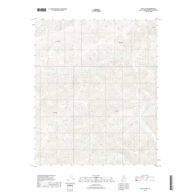
2018 Map of Circle A-5 NW
USGS Topo · Published 2018About this map
Mt Ryan dominates the northeastern corner of this interior Alaskan landscape, serving as the high point for a complex network of drainages in the Fairbanks North Star Borough. The terrain is defined by its watercourses, with Horse Creek and Smith Creek carving paths through the northern sections while the center is marked by the winding route of Frozenfoot Creek. To the south, the watershed of Olympia Creek (also labeled in parts as Olympia Creek) flows through the lower elevations. This modern survey reflects the undeveloped character of the region, showing a land still primarily shaped by its natural topography and hydrology rather than human settlement or industrial infrastructure. The map provides a precise look at the township and range boundaries, including t5n r6e, t5n r7e, t4n r6e, and t4n r7e, which anchor the legal geography of this remote wilderness area.
Find a feature on this map
10 named features on this map. Tap any name to fly to it.
Don’t see what you’re looking for? This feature index may not catch every label — zoom into the map to look around manually.
Map Details
Editions of this 2018 Circle A-5 NW Map
This is the sole edition of this map. No revisions or reprints were ever made.
Other maps of this area

1951 · Circle
USGS Topo · 1:250,000

1951 · Circle A-5
USGS Topo · 1:63,360

1952 · Circle A-5
USGS Topo · 1:63,360

1954 · Circle A-6
USGS Topo · 1:63,360

1954 · Circle B-6
USGS Topo · 1:63,360

1954 · Circle A-5
USGS Topo · 1:63,360

1954 · Circle B-5
USGS Topo · 1:63,360

1955 · Circle
USGS Topo · 1:250,000

1964 · Circle
USGS Topo · 1:250,000
2018 · Circle B-5 SW
USGS Topo · 1:25,000