
1954 Map of Circle B-6
USGS Topo · Published 1955About this map
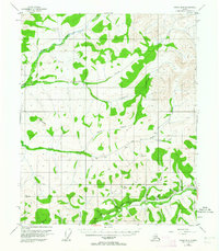
Davidson Ditch snakes across this interior Alaska landscape, representing a massive feat of early 20th-century gold-mining engineering designed to carry water to the Fairbanks district. This 1954 survey captures the infrastructure of the placer mining era, including a Siphon and several Placer Mine sites along Nome Creek and Moose Creek. The southern edge of the map is defined by the Chatanika River and the Steese Highway, where U S Camp stands as a focal point for travelers and workers in the region. The map reveals a remote wilderness punctuated by solitary cabins and a complex network of waterways like Champion Creek and Bear Creek that feed into the larger river systems. Table Top Mtn serves as a prominent landmark in the western section, while the drainage patterns of Cripple Creek and Caribou Creek illustrate the challenging terrain faced by prospectors and surveyors.
Find a feature on this map
27 named features on this map. Tap any name to fly to it.
Don’t see what you’re looking for? This feature index may not catch every label — zoom into the map to look around manually.
Map Details
Editions of this 1954 Circle B-6 Map
4 editions found
Other maps of this area

1945 · Livengood
USGS Topo · 1:250,000

1951 · Livengood
USGS Topo · 1:250,000

1951 · Circle
USGS Topo · 1:250,000

1951 · Circle A-5
USGS Topo · 1:63,360

1951 · Livengood C-1
USGS Topo · 1:63,360

1951 · Circle C-6
USGS Topo · 1:63,360

1952 · Livengood A-1
USGS Topo · 1:63,360

1952 · Circle C-5
USGS Topo · 1:63,360

1952 · Circle A-5
USGS Topo · 1:63,360

1954 · Circle C-5
USGS Topo · 1:63,360