
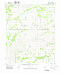
1952 Map of Circle C-5
USGS Topo · Published 1975About this map
Preacher Creek and its many tributaries dominate this interior Alaskan landscape as it was documented in the early 1950s. The drainage network is intricately detailed, showing the North Fork Preacher Creek winding through the northern reaches while the Costa Fork Preacher Creek and Bachelor Creek converge in the southeast. High elevation survey points such as VABM 4065 McKinley provide essential vertical control in this unpopulated wilderness area. This 1952 field-annotated study reveals a landscape defined entirely by its hydrology and relief, before modern infrastructure reached this part of the Yukon-Koyukuk region. Small waterways like Quartz Creek, Convert Creek, and Mc Kinley Creek underscore the area's geological complexity, offering a baseline for environmental historians and researchers of Alaskan interior water systems.
Find a feature on this map
9 named features on this map. Tap any name to fly to it.
Don’t see what you’re looking for? This feature index may not catch every label — zoom into the map to look around manually.
Map Details
Editions of this 1952 Circle C-5 Map
2 editions found
Other maps of this area

1951 · Circle
USGS Topo · 1:250,000

1951 · Circle D-6
USGS Topo · 1:63,360

1951 · Circle C-6
USGS Topo · 1:63,360

1952 · Circle D-4
USGS Topo · 1:63,360

1952 · Circle B-4
USGS Topo · 1:63,360

1952 · Circle C-4
USGS Topo · 1:63,360

1952 · Circle D-5
USGS Topo · 1:63,360

1954 · Circle C-5
USGS Topo · 1:63,360

1954 · Circle B-6
USGS Topo · 1:63,360

1954 · Circle D-5
USGS Topo · 1:63,360