
1952 Map of Circle B-4
USGS Topo · Published 1959About this map
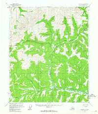
Steese Highway cuts through the high interior landscape, providing a vital transit corridor through the drainage systems of the Yukon-Koyukuk region. The survey centers on the significant divide at Twelvemile Summit, where the road follows the contours of the high ground between the headwaters of McKinley Creek and the valley of Twelvemile Creek. The landscape is defined by its complex hydrology, with the North Fork Birch Creek joining the main stem of Birch Creek in a network of winding waterways that include Harrington Creek and Fryingpan Creek. Industrial activity is evident near the eastern edge of the map, where a Placer Mine is situated along Butte Creek. This mid-century survey captures the early infrastructure of the Alaskan interior, showing isolated Cabin locations and surveying benchmarks like VABM 3375 Birch that served as critical anchors for mapping this expansive territory.
Find a feature on this map
26 named features on this map. Tap any name to fly to it.
Don’t see what you’re looking for? This feature index may not catch every label — zoom into the map to look around manually.
Map Details
Editions of this 1952 Circle B-4 Map
4 editions found
Other maps of this area

1951 · Circle
USGS Topo · 1:250,000

1951 · Circle A-5
USGS Topo · 1:63,360

1952 · Circle A-4
USGS Topo · 1:63,360

1952 · Circle C-4
USGS Topo · 1:63,360

1952 · Circle C-5
USGS Topo · 1:63,360

1952 · Circle A-5
USGS Topo · 1:63,360

1954 · Circle C-5
USGS Topo · 1:63,360

1954 · Circle A-5
USGS Topo · 1:63,360

1954 · Circle B-5
USGS Topo · 1:63,360

1955 · Circle B-3
USGS Topo · 1:63,360