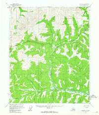
1952 Map of Circle B-4
USGS Topo · Published 1964About this map
Twelvemile Summit serves as a prominent high point in this interior Alaskan landscape, which was surveyed by the Geological Survey using aerial photography in the early 1950s. The region is defined by the complex drainage system of Birch Creek, including its North Fork and South Fork. The presence of a Placer Mine near Butte and labels like Eagle Creek Gold Dust point toward the area's history of mineral exploration. Transport through this remote terrain is centered on the Steese Highway, which winds across the northern half of the sheet. Scattered infrastructure is minimal, represented by an isolated Cabin along the river and various vertical angle bench marks like VABM 4472 Twelve. The intricate network of waterways, including Harrington Creek and Fryingpan Creek, illustrates the seasonal flow patterns characteristic of the Yukon-Koyukuk region before more modern developments.
Find a feature on this map
24 named features on this map. Tap any name to fly to it.
Don’t see what you’re looking for? This feature index may not catch every label — zoom into the map to look around manually.
Map Details
Editions of this 1952 Circle B-4 Map
4 editions found
Other maps of this area

1951 · Circle
USGS Topo · 1:250,000

1951 · Circle A-5
USGS Topo · 1:63,360

1952 · Circle A-4
USGS Topo · 1:63,360

1952 · Circle B-4
USGS Topo · 1:63,360

1952 · Circle C-4
USGS Topo · 1:63,360

1952 · Circle C-5
USGS Topo · 1:63,360

1952 · Circle A-5
USGS Topo · 1:63,360

1954 · Circle C-5
USGS Topo · 1:63,360

1954 · Circle A-5
USGS Topo · 1:63,360

1954 · Circle B-5
USGS Topo · 1:63,360