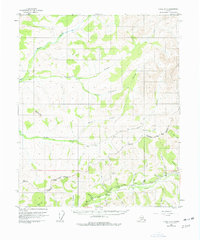
1954 Map of Circle B-6
USGS Topo · Published 1977About this map
The Chatanika River valley dominates this interior Alaskan landscape, a region defined by mid-century resource extraction and transportation. Following the valley floor, the Steese Highway provides the primary artery for the area, passing through U S Camp and connecting isolated mining operations to the wider territory. The terrain is a complex network of drainage basins, where the headwaters of Nome Creek and Champion Creek are marked by several Placer Mine locations and scattered cabins.
Find a feature on this map
28 named features on this map. Tap any name to fly to it.
Don’t see what you’re looking for? This feature index may not catch every label — zoom into the map to look around manually.
Map Details
Editions of this 1954 Circle B-6 Map
4 editions found

Other maps of this area

1945 · Livengood
USGS Topo · 1:250,000

1951 · Livengood
USGS Topo · 1:250,000

1951 · Circle
USGS Topo · 1:250,000

1951 · Circle A-5
USGS Topo · 1:63,360

1951 · Livengood C-1
USGS Topo · 1:63,360

1951 · Circle C-6
USGS Topo · 1:63,360

1952 · Livengood A-1
USGS Topo · 1:63,360

1952 · Circle C-5
USGS Topo · 1:63,360

1952 · Circle A-5
USGS Topo · 1:63,360

1954 · Circle C-5
USGS Topo · 1:63,360