
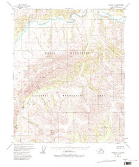
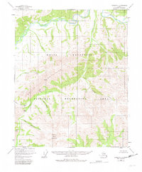
1951 Map of Livengood C-1
USGS Topo · Published 1971About this map
The White Mountains dominate this 1951 topographical study, characterized by high-elevation ridges and deep drainage systems in interior Alaska. The landscape is defined by the winding course of Beaver Creek in the north and the prominent heights of Cache Mountain and Windy Gap to the south. This area, largely unsurveyed by the Bureau of Land Management at the time, shows very little human development beyond a lone Cabin near the northern creek.
Find a feature on this map
10 named features on this map. Tap any name to fly to it.
Don’t see what you’re looking for? This feature index may not catch every label — zoom into the map to look around manually.
Map Details
Editions of this 1951 Livengood C-1 Map
3 editions found
Other maps of this area

1945 · Livengood
USGS Topo · 1:250,000

1951 · Livengood
USGS Topo · 1:250,000

1951 · Circle
USGS Topo · 1:250,000

1951 · Circle D-6
USGS Topo · 1:63,360

1951 · Livengood C-2
USGS Topo · 1:63,360

1951 · Circle C-6
USGS Topo · 1:63,360

1951 · Livengood B-2
USGS Topo · 1:63,360

1952 · Livengood D-2
USGS Topo · 1:63,360

1952 · Livengood D-1
USGS Topo · 1:63,360

1954 · Livengood C-2
USGS Topo · 1:63,360