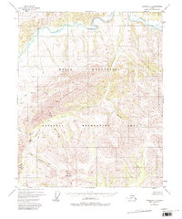
1951 Map of Livengood C-1
USGS Topo · Published 1981About this map
The White Mountains dominate this 1951 aerial photogrammetric survey, showcasing a landscape of high ridges and winding waterways within the White Mountains National Recreation Area. The meandering course of Beaver Creek carves through the northern reaches, while prominent landmarks like Cache Mountain and Windy Gap define the southern interior.
Find a feature on this map
16 named features on this map. Tap any name to fly to it.
Don’t see what you’re looking for? This feature index may not catch every label — zoom into the map to look around manually.
Map Details
Editions of this 1951 Livengood C-1 Map
3 editions found
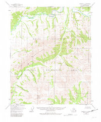
Other maps of this area

1945 · Livengood
USGS Topo · 1:250,000

1951 · Livengood
USGS Topo · 1:250,000

1951 · Circle
USGS Topo · 1:250,000

1951 · Circle D-6
USGS Topo · 1:63,360

1951 · Livengood C-2
USGS Topo · 1:63,360

1951 · Livengood C-1
USGS Topo · 1:63,360

1951 · Circle C-6
USGS Topo · 1:63,360

1951 · Livengood B-2
USGS Topo · 1:63,360

1952 · Livengood D-2
USGS Topo · 1:63,360

1952 · Livengood D-1
USGS Topo · 1:63,360