
1952 Map of Livengood D-1
USGS Topo · Published 1968About this map
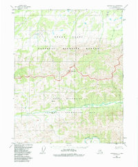
Mt Schwatka rises as a prominent landmark in this interior Alaskan wilderness, as documented during the early 1950s. The landscape is defined by its complex drainage network, where the waters of Victoria Creek and Beaver Creek dominate the lower elevations. Numerous smaller watercourses such as Deadwood Creek, Jefferson Creek, and Bull Creek carve through the high ground, illustrating the natural water shed patterns of the region before any modern infrastructure development. This survey reveals a land primarily shaped by topography and hydrologic systems, with triangulation stations like VABM 2849 Victoria marking the highest points for early cartographers. The confluence of the West Fork Flat Creek and East Fork Flat Creek provides a clear view of the tributary systems that feed the larger river basins of the Yukon-Koyukuk area.
Find a feature on this map
11 named features on this map. Tap any name to fly to it.
Don’t see what you’re looking for? This feature index may not catch every label — zoom into the map to look around manually.
Map Details
Editions of this 1952 Livengood D-1 Map
2 editions found
Other maps of this area

1945 · Livengood
USGS Topo · 1:250,000

1951 · Fort Yukon
USGS Topo · 1:250,000

1951 · Livengood
USGS Topo · 1:250,000

1951 · Beaver
USGS Topo · 1:250,000

1951 · Circle
USGS Topo · 1:250,000

1951 · Circle D-6
USGS Topo · 1:63,360

1951 · Livengood C-2
USGS Topo · 1:63,360

1951 · Livengood C-1
USGS Topo · 1:63,360

1951 · Circle C-6
USGS Topo · 1:63,360

1952 · Livengood D-2
USGS Topo · 1:63,360