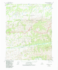
1952 Map of Livengood D-1
USGS Topo · Published 1988About this map
White Mountains dominates the central portion of this 1950s era survey, a terrain of high ridges and drainage basins that define the headwaters of several major interior Alaska watercourses. The prominent peak of Mt Schwatka stands as a focal point along the drainage divide, separating the southern flowing waters of the Beaver Creek and Victoria Creek systems from the northern expanse of the Yukon Flats.
Find a feature on this map
14 named features on this map. Tap any name to fly to it.
Don’t see what you’re looking for? This feature index may not catch every label — zoom into the map to look around manually.
Map Details
Editions of this 1952 Livengood D-1 Map
2 editions found

Other maps of this area

1945 · Livengood
USGS Topo · 1:250,000

1951 · Fort Yukon
USGS Topo · 1:250,000

1951 · Livengood
USGS Topo · 1:250,000

1951 · Beaver
USGS Topo · 1:250,000

1951 · Circle
USGS Topo · 1:250,000

1951 · Circle D-6
USGS Topo · 1:63,360

1951 · Livengood C-2
USGS Topo · 1:63,360

1951 · Livengood C-1
USGS Topo · 1:63,360

1951 · Circle C-6
USGS Topo · 1:63,360

1952 · Livengood D-2
USGS Topo · 1:63,360