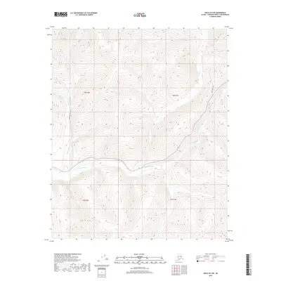
2018 Map of Circle B-5 SW
USGS Topo · Published 2018About this map
The Chatanika River serves as the central drainage for this section of the Fairbanks North Star Borough, winding through a landscape defined by named drainages and seasonal watercourses. Access into these uplands is primarily provided by Sourdough Creek Road in the west and Faith Creek Road in the northeast, reflecting the importance of transportation routes for interior exploration. The map details numerous smaller tributaries such as Faith Cr and McManus Cr, which converge toward the main river valley. Notable for local history and prospecting interests are specifically named features like Glacier Pup and Tough Luck Cr, names that suggest the character of early Alaskan mineral exploration. The terrain is further dissected by Sourdough Cr, Ruby Cr, and Smith Cr, illustrating the complex hydrological network typical of the Alaska Interior.
Find a feature on this map
20 named features on this map. Tap any name to fly to it.
Don’t see what you’re looking for? This feature index may not catch every label — zoom into the map to look around manually.
Map Details
Editions of this 2018 Circle B-5 SW Map
This is the sole edition of this map. No revisions or reprints were ever made.
Other maps of this area

1951 · Circle
USGS Topo · 1:250,000

1951 · Circle A-5
USGS Topo · 1:63,360

1952 · Circle A-5
USGS Topo · 1:63,360

1954 · Circle A-6
USGS Topo · 1:63,360

1954 · Circle B-6
USGS Topo · 1:63,360

1954 · Circle A-5
USGS Topo · 1:63,360

1954 · Circle B-5
USGS Topo · 1:63,360

1955 · Circle
USGS Topo · 1:250,000

1964 · Circle
USGS Topo · 1:250,000
2018 · Circle B-5 NE
USGS Topo · 1:25,000