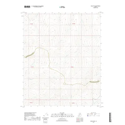
2018 Map of Circle B-5 NE
USGS Topo · Published 2018About this map
Homestake Cr and Charity Cr flow through this mountainous interior, where the high-altitude terrain of the Yukon-Koyukuk and Fairbanks North Star regions is defined by a complex network of drainages. The landscape is marked by the jurisdictional divide of the Yukon-Koyukuk Census Area and Fairbanks North Star Borough, a boundary that snakes across the ridges. Numerous small waterways including Bachelor Cr, Montana Cr, and McKinley Cr originate in these hills, indicating a watershed system that has long influenced navigation and prospecting in this part of Alaska. This 2018 survey detail provides a modern topographic record of the remote slopes between McManus Cr and American Cr.
Find a feature on this map
16 named features on this map. Tap any name to fly to it.
Don’t see what you’re looking for? This feature index may not catch every label — zoom into the map to look around manually.
Map Details
Editions of this 2018 Circle B-5 NE Map
This is the sole edition of this map. No revisions or reprints were ever made.
Other maps of this area

1951 · Circle
USGS Topo · 1:250,000

1952 · Circle B-4
USGS Topo · 1:63,360

1952 · Circle C-4
USGS Topo · 1:63,360

1952 · Circle C-5
USGS Topo · 1:63,360

1954 · Circle C-5
USGS Topo · 1:63,360

1954 · Circle B-5
USGS Topo · 1:63,360

1955 · Circle
USGS Topo · 1:250,000

1964 · Circle
USGS Topo · 1:250,000
2018 · Circle B-5 SW
USGS Topo · 1:25,000
2018 · Circle B-5 NW
USGS Topo · 1:25,000