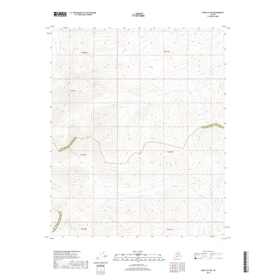
2018 Map of Circle B-5 NW
USGS Topo · Published 2018About this map
Mt Prindle stands as the dominant topographical landmark in this interior Alaskan wilderness, situated along the border of the Yukon-Koyukuk Census Area and Fairbanks North Star Borough. The high-elevation terrain is defined by a radial drainage pattern, where numerous named creeks descend from the central massif. To the south, the waters of Hope Cr and Faith Cr converge, joined further east by Charity Cr. This cluster of virtue-named streams suggests a thematic naming convention common among early prospectors or surveyors in the region.
Find a feature on this map
15 named features on this map. Tap any name to fly to it.
Don’t see what you’re looking for? This feature index may not catch every label — zoom into the map to look around manually.
Map Details
Editions of this 2018 Circle B-5 NW Map
This is the sole edition of this map. No revisions or reprints were ever made.
Other maps of this area

1951 · Circle
USGS Topo · 1:250,000

1951 · Circle C-6
USGS Topo · 1:63,360

1952 · Circle C-5
USGS Topo · 1:63,360

1954 · Circle C-5
USGS Topo · 1:63,360

1954 · Circle B-6
USGS Topo · 1:63,360
1954 · Circle C-6
USGS Topo · 1:63,360

1954 · Circle B-5
USGS Topo · 1:63,360

1955 · Circle
USGS Topo · 1:250,000

1964 · Circle
USGS Topo · 1:250,000
2018 · Circle B-5 SW
USGS Topo · 1:25,000