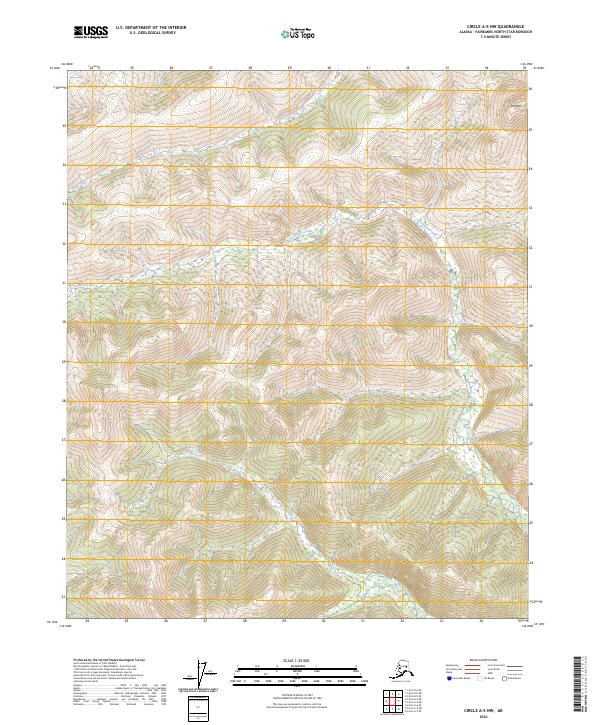
2024 Map of Circle A-5 NW
USGS Topo · Published 2024About this map
Mt Ryan anchors the northeastern corner of this interior Alaska landscape, overlooking a series of complex drainage systems that define the Fairbanks North Star Borough. The terrain is characterized by the headwaters and winding paths of several watercourses, most notably Frozenfoot Creek and Smith Creek, which carve through the high elevations of the Circle A-5 NW quadrangle. The map reflects a largely undeveloped wilderness within the Public Land Survey System, showing the township and range divisions of t5n r6e, t5n r7e, t4n r6e, and t4n r7e. Other smaller drainages like Horse Creek and Olympia Creek further illustrate the watershed patterns of this remote northern territory.
Find a feature on this map
9 named features on this map. Tap any name to fly to it.
Don’t see what you’re looking for? This feature index may not catch every label — zoom into the map to look around manually.
Map Details
Editions of this 2024 Circle A-5 NW Map
This is the sole edition of this map. No revisions or reprints were ever made.
Other maps of this area

1951 · Circle
USGS Topo · 1:250,000

1951 · Circle A-5
USGS Topo · 1:63,360

1952 · Circle A-5
USGS Topo · 1:63,360

1954 · Circle A-6
USGS Topo · 1:63,360

1954 · Circle B-6
USGS Topo · 1:63,360

1954 · Circle A-5
USGS Topo · 1:63,360

1954 · Circle B-5
USGS Topo · 1:63,360

1955 · Circle
USGS Topo · 1:250,000

1964 · Circle
USGS Topo · 1:250,000
2018 · Circle B-5 SW
USGS Topo · 1:25,000