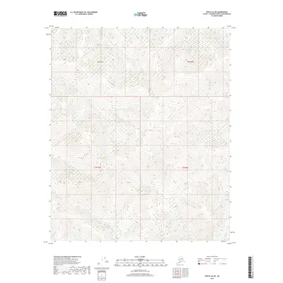
2018 Map of Circle A-6 NE
USGS Topo · Published 2018About this map
Little Chena River and its upper tributaries dominate this portion of the interior Alaskan wilderness within the Fairbanks North Star Borough. The terrain is defined by a dense network of watercourses, including Cassiar Cr, Modoc Cr, and Smith Cr, which carve through the high elevations of the Yukon-Tanana Upland. This 2018 survey illustrates the complex drainage patterns of the subarctic landscape, where smaller features like Third Pup and Soggy Cr feed into the larger river system. The lack of roads or established settlements emphasizes the remote nature of the region, providing a baseline for environmental study or backcountry navigation. The map also delineates the boundaries for Townships 4 and 5 North within Ranges 5 and 6 East, offering a precise look at the Public Land Survey System in this undeveloped territory.
Find a feature on this map
11 named features on this map. Tap any name to fly to it.
Don’t see what you’re looking for? This feature index may not catch every label — zoom into the map to look around manually.
Map Details
Editions of this 2018 Circle A-6 NE Map
This is the sole edition of this map. No revisions or reprints were ever made.
Other maps of this area

1951 · Circle
USGS Topo · 1:250,000

1951 · Circle A-5
USGS Topo · 1:63,360

1952 · Circle A-5
USGS Topo · 1:63,360

1954 · Circle A-6
USGS Topo · 1:63,360

1954 · Circle B-6
USGS Topo · 1:63,360

1954 · Circle A-5
USGS Topo · 1:63,360

1954 · Circle B-5
USGS Topo · 1:63,360

1955 · Circle
USGS Topo · 1:250,000

1964 · Circle
USGS Topo · 1:250,000
2018 · Circle B-5 SW
USGS Topo · 1:25,000