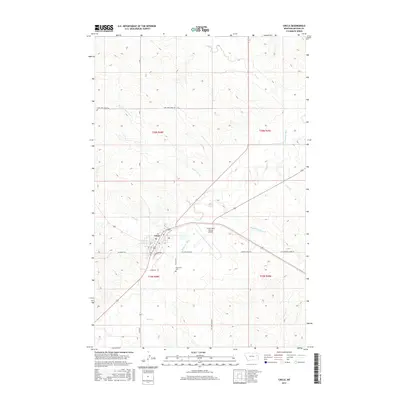
2017 Map of Circle
USGS Topo · Published 2017About this map
Circle serves as the focal point of this Eastern Montana landscape, situated at the confluence of several regional drainages. The Redwater River flows northward past the town, joined by numerous seasonal watercourses including Horse Cr, Lone Tree Cr, and Buffalo Springs Cr. The layout of the area is defined by a strictly surveyed grid of section lines and gravel routes, such as McCune Creek Rd and Union Rd, which connect the town to outlying ranchlands. Local infrastructure is concentrated around the town's perimeter, where the Circle Town County Airport and Riverview Cem provide essential community services. The map captures the specialized topography of McCone County, where flat-topped divides separate deeply incised creek beds like Hell Cr and Lost Cr, illustrating the drainage patterns that have dictated settlement and road placement in this part of the plains.
Find a feature on this map
21 named features on this map. Tap any name to fly to it.
Don’t see what you’re looking for? This feature index may not catch every label — zoom into the map to look around manually.
Map Details
Editions of this 2017 Circle Map
This is the sole edition of this map. No revisions or reprints were ever made.
Other maps of this area

1954 · Glendive
USGS Topo · 1:250,000

1957 · Glendive
USGS Topo · 1:250,000

1958 · Glendive
USGS Topo · 1:250,000

1982 · Circle
USGS Topo · 1:100,000

1983 · Youngquist Mine
USGS Topo · 1:24,000

1983 · Haynie Reservoir
USGS Topo · 1:24,000

1983 · Woodworth Hill
USGS Topo · 1:24,000

1983 · Mount Antelope
USGS Topo · 1:24,000

1983 · Quick Reservoir
USGS Topo · 1:24,000

1983 · Buffalo Creek
USGS Topo · 1:24,000