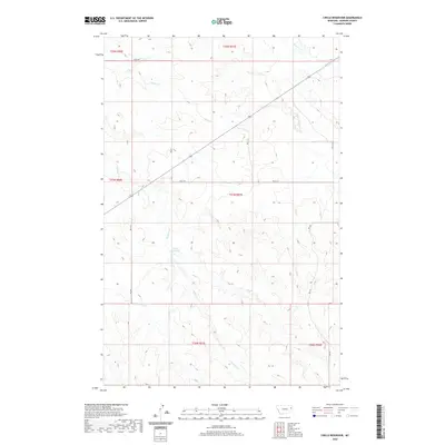
2020 Map of Circle Reservoir
USGS Topo · Published 2020About this map
Circle Reservoir serves as a central landmark in this Dawson County landscape, where the drainage patterns of the Missouri River basin are clearly defined by numerous creek systems. The map shows the convergence of Sullivan Cr as it flows toward the reservoir, alongside the winding paths of Alkali Cr and Pasture Cr. The terrain is marked by a network of rural routes and secondary roads, including Rd 412 and Rd P 8-S, which facilitate travel across these sprawling Montana sections. The detailed inclusion of Field Trl routes and the headwaters of the E Fork Pasture Cr and W Fork Pasture Cr illustrate the remote, water-dependent geography of the High Plains, providing a clear record of the local land use and infrastructure at this point in the twenty-first century.
Find a feature on this map
18 named features on this map. Tap any name to fly to it.
Don’t see what you’re looking for? This feature index may not catch every label — zoom into the map to look around manually.
Map Details
Editions of this 2020 Circle Reservoir Map
This is the sole edition of this map. No revisions or reprints were ever made.
Other maps of this area

1954 · Glendive
USGS Topo · 1:250,000

1957 · Glendive
USGS Topo · 1:250,000

1958 · Glendive
USGS Topo · 1:250,000

1982 · Circle
USGS Topo · 1:100,000

1983 · Johnson Reservoir NW
USGS Topo · 1:24,000
1983 · Richey
USGS Topo · 1:24,000

1983 · Buffalo Creek NE
USGS Topo · 1:24,000

1983 · Circle Reservoir
USGS Topo · 1:24,000
1983 · Johnson Reservoir NE
USGS Topo · 1:24,000

1983 · Richey NW
USGS Topo · 1:24,000