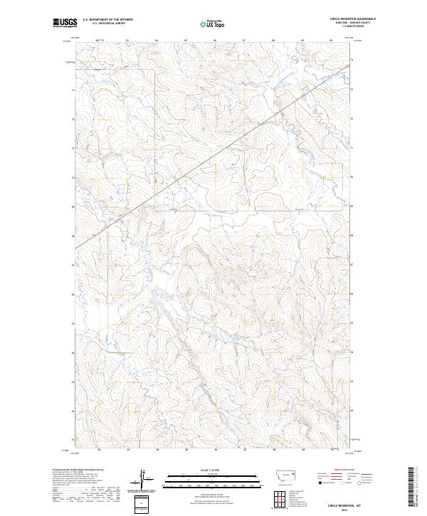
2024 Map of Circle Reservoir
USGS Topo · Published 2024About this map
Alkali Creek and Sullivan Creek carve through the high plains of Dawson County, defining a landscape dominated by drainage patterns and seasonal watercourses. This map of the Circle Reservoir area highlights a transition from traditional routes like Field Trl to a more structured grid of rural roads, including Rd 621 and Rd N 115. The eastern portion of the quadrangle is shaped by the headwaters of Pasture Creek, where the West Fork Pasture Creek and East Fork Pasture Creek meet. These labels reflect the vital role of water management and livestock movement in this part of Montana. The lack of large towns emphasizes the vast, open nature of these townships, where development is largely limited to the maintenance of access roads like Rd M 13-5 and Rd 412.
Find a feature on this map
17 named features on this map. Tap any name to fly to it.
Don’t see what you’re looking for? This feature index may not catch every label — zoom into the map to look around manually.
Map Details
Editions of this 2024 Circle Reservoir Map
This is the sole edition of this map. No revisions or reprints were ever made.
Other maps of this area

1954 · Glendive
USGS Topo · 1:250,000

1957 · Glendive
USGS Topo · 1:250,000

1958 · Glendive
USGS Topo · 1:250,000

1982 · Circle
USGS Topo · 1:100,000

1983 · Johnson Reservoir NW
USGS Topo · 1:24,000
1983 · Richey
USGS Topo · 1:24,000

1983 · Buffalo Creek NE
USGS Topo · 1:24,000

1983 · Circle Reservoir
USGS Topo · 1:24,000
1983 · Johnson Reservoir NE
USGS Topo · 1:24,000

1983 · Richey NW
USGS Topo · 1:24,000