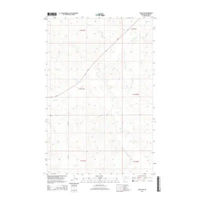
2014 Map of Circle SW
USGS Topo · Published 2014About this map
Redwater River and its network of dry-land tributaries define this McCone County landscape, which remains primarily organized around the Public Land Survey System. The map documents a sparsely settled region of the Great Plains, where the Brost Cem stands as a significant point of interest for genealogists and local historians. This area, located south of the main Big Dry drainage, is characterized by a series of long, branching creek beds including Antelope Cr, Stony Butte Cr, and the winding Tusler Cr. Transportation is limited to primary corridors like Mt-200 and Mt-510, which cut across the high-plateau sections of t18n r47e and surrounding townships. This 2014 survey captures the persistence of large-scale land divisions and the isolated nature of ranching infrastructure in eastern Montana.
Find a feature on this map
17 named features on this map. Tap any name to fly to it.
Don’t see what you’re looking for? This feature index may not catch every label — zoom into the map to look around manually.
Map Details
Editions of this 2014 Circle SW Map
This is the sole edition of this map. No revisions or reprints were ever made.
Other maps of this area

1954 · Glendive
USGS Topo · 1:250,000

1957 · Glendive
USGS Topo · 1:250,000

1958 · Glendive
USGS Topo · 1:250,000

1965 · Watkins
USGS Topo · 1:24,000

1982 · Circle
USGS Topo · 1:100,000

1983 · Youngquist Mine
USGS Topo · 1:24,000

1983 · Brockway NE
USGS Topo · 1:24,000

1983 · Quick Reservoir
USGS Topo · 1:24,000

1983 · Circle
USGS Topo · 1:24,000
1983 · Brockway
USGS Topo · 1:24,000