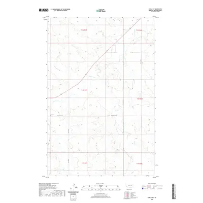
2020 Map of Circle SW
USGS Topo · Published 2020About this map
The Redwater River meanders across this rural section of McCone County, Montana, carving a path through a landscape defined by its complex drainage network. To the west, Stony Butte Cr and Ash Cr feed the larger basin, while the eastern reaches are marked by the branching courses of Tusler Cr and Pasture Cr. The terrain is sparsely settled, with the local geography organized primarily by the Public Land Survey System grids of t18n r47e and surrounding townships.
Find a feature on this map
17 named features on this map. Tap any name to fly to it.
Don’t see what you’re looking for? This feature index may not catch every label — zoom into the map to look around manually.
Map Details
Editions of this 2020 Circle SW Map
This is the sole edition of this map. No revisions or reprints were ever made.
Other maps of this area

1954 · Glendive
USGS Topo · 1:250,000

1957 · Glendive
USGS Topo · 1:250,000

1958 · Glendive
USGS Topo · 1:250,000

1965 · Watkins
USGS Topo · 1:24,000

1982 · Circle
USGS Topo · 1:100,000

1983 · Youngquist Mine
USGS Topo · 1:24,000

1983 · Brockway NE
USGS Topo · 1:24,000

1983 · Quick Reservoir
USGS Topo · 1:24,000

1983 · Circle
USGS Topo · 1:24,000
1983 · Brockway
USGS Topo · 1:24,000