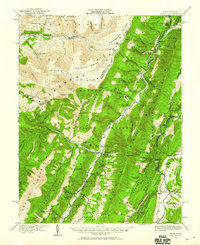
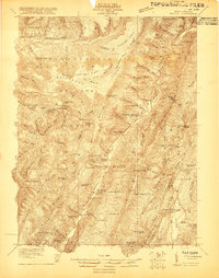
1922 Map of Circleville
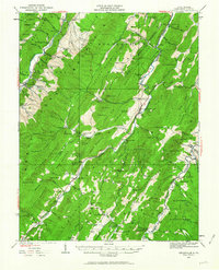
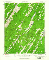
USGS Topo · Published 1964About this map
South Fork Potomac River carves through a landscape dominated by the high ridges of Spruce Mountain and North Fork Mountain, creating a network of isolated valleys where early 20th-century life centered on family-named schools and small parish churches. The density of educational sites is particularly high, with institutions like Brooklyn School, Drops Gap School, and Painter School serving the dispersed mountain communities.
Find a feature on this map
147 named features on this map. Tap any name to fly to it.
Don’t see what you’re looking for? This feature index may not catch every label — zoom into the map to look around manually.
Map Details
Editions of this 1922 Circleville Map
2 editions found
Other maps of this area

1889 · Beverly
USGS Topo · 1:125,000

1892 · Beverly
USGS Topo · 1:125,000

1892 · Franklin
USGS Topo · 1:125,000

1894 · Staunton
USGS Topo · 1:125,000

1896 · Franklin
USGS Topo · 1:125,000

1901 · Monterey
USGS Topo · 1:125,000

1920 · Petersburg
USGS Topo · 1:48,000
1920 · Onego
USGS Topo · 1:62,500

1921 · Petersburg
USGS Topo · 1:48,000
1921 · Onego
USGS Topo · 1:48,000