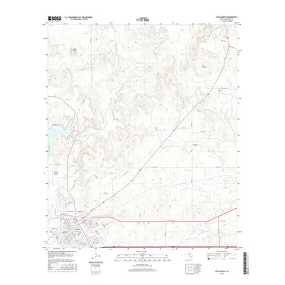
2016 Map of Cisco North
USGS Topo · Published 2016About this map
The city of Cisco occupies the southern edge of this West Texas landscape, where the street grid meets the higher educational grounds of Cisco Coll. To the north, the terrain becomes more complex as the N Fork Leon River and Middle Fork Leon River snake through a series of ridges and draws. Significant local landmarks like Lake Cisco and the Cisco Municipal Airport serve as central infrastructure for the region, while the northern uplands are punctuated by prominent elevations such as Cedar Mtn and Flat Top Mtn.
Find a feature on this map
72 named features on this map. Tap any name to fly to it.
Don’t see what you’re looking for? This feature index may not catch every label — zoom into the map to look around manually.
Map Details
Editions of this 2016 Cisco North Map
This is the sole edition of this map. No revisions or reprints were ever made.
Other maps of this area

1890 · Breckenridge
USGS Topo · 1:125,000

1892 · Albany
USGS Topo · 1:125,000

1893 · Albany
USGS Topo · 1:125,000

1894 · Eastland
USGS Topo · 1:125,000

1931 · Baird
USGS Topo · 1:125,000

1932 · Baird
USGS Topo · 1:125,000

1954 · Abilene
USGS Topo · 1:250,000

1958 · Abilene
USGS Topo · 1:250,000

1965 · Indian Knoll
USGS Topo · 1:24,000

1966 · Cisco North
USGS Topo · 1:24,000