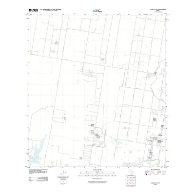
2010 Map of Citrus City
USGS Topo · Published 2010About this map
Citrus City and its surrounding colonias anchor this 2010 survey of Hidalgo County, showing the unique residential and agricultural landscape of the Rio Grande Valley. The map documents a dense network of named residential developments, including Puerta Blanca Colonia, Daniel Ozuna Colonia, and Basham Number 16 Colonia, reflecting the region's rapid 21st-century growth. These settlements are interspersed with long-standing ranching landmarks such as Santa Rita Ranch and El Veleno Ranch, alongside the industrial presence of the Tabasco Oil and Gas Field in the south.
Find a feature on this map
44 named features on this map. Tap any name to fly to it.
Don’t see what you’re looking for? This feature index may not catch every label — zoom into the map to look around manually.
Map Details
Editions of this 2010 Citrus City Map
This is the sole edition of this map. No revisions or reprints were ever made.
Other maps of this area

1940 · Monte Christo
USGS Topo · 1:62,500

1949 · Mc Allen
USGS Topo · 1:250,000

1954 · McAllen
USGS Topo · 1:250,000

1956 · Garcias
USGS Topo · 1:62,500

1956 · Los Ebanos
USGS Topo · 1:62,500

1957 · Mc Allen
USGS Topo · 1:250,000

1962 · McAllen
USGS Topo · 1:250,000

1963 · Monte Christo
USGS Topo · 1:24,000

1963 · La Joya
USGS Topo · 1:24,000

1963 · Citrus City
USGS Topo · 1:24,000