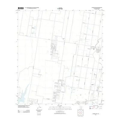
2012 Map of Citrus City
USGS Topo · Published 2012About this map
Citrus City and the neighboring settlement of Doffing anchor this 2012 survey of the South Texas landscape in Hidalgo County. The region is defined by its rectilinear road grid, including the sequential 10 Mile Line and 9 Mile Line, which organize the agricultural and residential plots of the Rio Grande Valley. These named lines, alongside major thoroughfares like Tom Gill Rd and Abram Rd, reveal a pattern of late 20th and early 21st-century development, where traditional cattle operations like El Veleno Ranch and Santa Rita Ranch exist alongside modern residential streets. In the southern reaches of the map, the Tabasco Oil and Gas Field indicates the industrial footprint of the energy sector, while the waters of La Joya Lake and the solitary La Morita Windmill provide a connection to the area's essential water resources and older ranching heritage.
Find a feature on this map
85 named features on this map. Tap any name to fly to it.
Don’t see what you’re looking for? This feature index may not catch every label — zoom into the map to look around manually.
Map Details
Editions of this 2012 Citrus City Map
This is the sole edition of this map. No revisions or reprints were ever made.
Other maps of this area

1940 · Monte Christo
USGS Topo · 1:62,500

1949 · Mc Allen
USGS Topo · 1:250,000

1954 · McAllen
USGS Topo · 1:250,000

1956 · Garcias
USGS Topo · 1:62,500

1956 · Los Ebanos
USGS Topo · 1:62,500

1957 · Mc Allen
USGS Topo · 1:250,000

1962 · McAllen
USGS Topo · 1:250,000

1963 · Monte Christo
USGS Topo · 1:24,000

1963 · La Joya
USGS Topo · 1:24,000

1963 · Citrus City
USGS Topo · 1:24,000