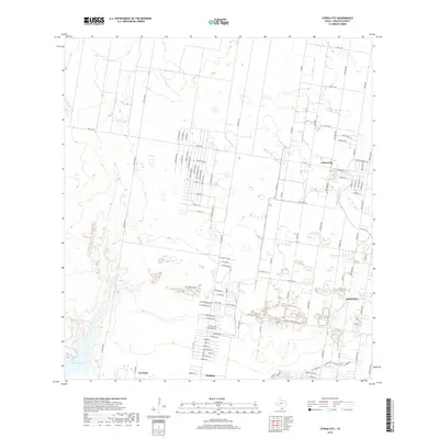
2019 Map of Citrus City
USGS Topo · Published 2019About this map
Citrus City and the neighboring settlements of Doffing, Penitas, and La Joya define the developing landscape of western Hidalgo County in this 2019 survey. The area shows a transition from open terrain to a dense residential grid, particularly evident in the naming of streets such as Royal Palm Dr, Coconut Palm Dr, and Sago Palm Dr. To the west, the landscape is marked by the distinct draws of Jara Chinas and the waters of La Joya Lake. The network of thoroughfares, including Mile 7 Rd and Tom Gill Rd, provides the structure for the region's expansion. This modern record captures the intricate street layouts and named circles that have emerged between the traditional ranch roads, reflecting the continued growth of these South Texas communities near the Rio Grande Valley corridor.
Find a feature on this map
95 named features on this map. Tap any name to fly to it.
Don’t see what you’re looking for? This feature index may not catch every label — zoom into the map to look around manually.
Map Details
Editions of this 2019 Citrus City Map
This is the sole edition of this map. No revisions or reprints were ever made.
Other maps of this area

1940 · Monte Christo
USGS Topo · 1:62,500

1949 · Mc Allen
USGS Topo · 1:250,000

1954 · McAllen
USGS Topo · 1:250,000

1956 · Garcias
USGS Topo · 1:62,500

1956 · Los Ebanos
USGS Topo · 1:62,500

1957 · Mc Allen
USGS Topo · 1:250,000

1962 · McAllen
USGS Topo · 1:250,000

1963 · Monte Christo
USGS Topo · 1:24,000

1963 · La Joya
USGS Topo · 1:24,000

1963 · Citrus City
USGS Topo · 1:24,000