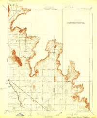
1924 Map of Citrus Cove
USGS Topo · Published 1929About this map
The town of Orange Cove sits at the base of the Sierra Nevada foothills during the early 1920s, a period defined by the expansion of citrus agriculture in the San Joaquin Valley. The landscape transition is marked by the Alta Irrigation District Canal, which underscores the vital role of water management in transforming this arid terrain into a productive orchard district. The Atchison Topeka and Santa Fe railroad cuts diagonally across the valley floor, providing the essential transport link for the region's agricultural output.
Find a feature on this map
13 named features on this map. Tap any name to fly to it.
Don’t see what you’re looking for? This feature index may not catch every label — zoom into the map to look around manually.
Map Details
Editions of this 1924 Citrus Cove Map
2 editions found
Other maps of this area

1920 · Orangedale School
USGS Topo · 1:24,000

1921 · Squaw Valley
USGS Topo · 1:31,680

1921 · Stokes Mountain
USGS Topo · 1:24,000

1922 · Trimmer
USGS Topo · 1:96,000

1923 · Sultana
USGS Topo · 1:31,680

1923 · Orangedale School
USGS Topo · 1:31,680

1923 · Wahtoke
USGS Topo · 1:31,680

1924 · Reedley
USGS Topo · 1:31,680

1924 · Citrus Cove
USGS Topo · 1:31,680

1924 · Dinuba
USGS Topo · 1:125,000