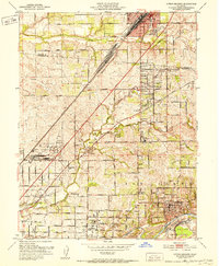
1951 Map of Citrus Heights
USGS Topo · Published 1952About this map
The Southern Pacific railroad corridor and the winding American River define the development of this northern Sacramento Valley landscape during the early 1950s. At the southern edge, the American River reveals extensive Dredge Tailings near Sailor Bar, signaling the era's heavy industrial extraction along the water's edge. The transition from rural ranching to suburban settlement is visible in the network of established institutions like San Juan Union H S, Sylvan Sch, and the Laymens Retreat House.
Find a feature on this map
52 named features on this map. Tap any name to fly to it.
Don’t see what you’re looking for? This feature index may not catch every label — zoom into the map to look around manually.
Map Details
Editions of this 1951 Citrus Heights Map
3 editions found
Other maps of this area

1891 · Sacramento
USGS Topo · 1:125,000

1892 · Sacramento
USGS Topo · 1:125,000

1893 · Sacramento
USGS Topo · 1:125,000

1902 · Fairoaks
USGS Topo · 1:62,500

1908 · Buffalo Creek
USGS Topo · 1:31,680

1910 · Roseville
USGS Topo · 1:31,680

1910 · Pleasant Grove
USGS Topo · 1:31,680

1911 · Brighton
USGS Topo · 1:31,680

1911 · Mills
USGS Topo · 1:31,680

1911 · Arcade
USGS Topo · 1:31,680